Sunday, September 21, 2008

It's Getting Late

Crestone Needle dominated the landscape from every direction; it's steep and imposing and reminds me a bit of the Trango Towers in Pakistan.

On Thursday night, Greg, Dusty and I left Denver for the South Colony Lakes, nestled high in the Sangre de Cristo Mountains, to set up base camp and do some hiking over the weekend. Dusty's Jeep carried us up a challenging 5.5 miles of rocky road, saving us a ton of time and allowing us to pack "heavy" for the weekend. We arrived at the upper parking lot around 2am on Friday, and hiked into the South Colony Lakes area, setting up base camp in the dark around 3:15. We left camp at 4:20 to begin our hike up Humboldt Peak, which seemed like a straightforward first ascent for the weekend. Fresh snow kept the 2.4 mile hike interesting, and the wind kept it cold. But it was all worth the effort when we summited just before the sun rose over the Wet Mountains to the east.

Greg on Humboldt signing the register just after sunrise.

Looking north through the Sangre de Cristo range from Humboldt Peak.

After fielding the most ridiculous question I've heard since living in Alaska, we returned to a sunny camp at 8:30 to cook breakfast and drink PBR in celebration of a successful hike. I passed out moments later, waking at 1pm to eat again before falling asleep again. I woke at 3:30 to a blast of winter in the valley (see video).


Enjoying "blue ribbon" beer in base camp at 9am after our first summit.

We slept most of the remainder of the afternoon recovering, and after dinner, we slept all night preparing for the next day's hike. We decided to attempt Crestone Peak and Needle via the northwest couloir, but changed plans after reaching Bear's Playground, a high saddle with descending views to the San Luis Valley to the west and the Wet mountains to the east. It's a unique position as it's a simple saddle dividing the Sangre de Cristo Mountains, and it's windy as hell. Instead of hiking the Crestones, we hiked northwest, gaining Challenger Point and Kit Carson Peak. It ended up being a long day, but we were rewarded with great weather during our hike back to camp (followed by more PBR).

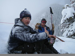
Greg pauses on the way back to camp.

Crestone Needle (left) and Crestone Peak during our descent from Humboldt.

That night, the weather turned again bad and it rained and snowed heavily for nearly 3 hours. We were holed up in our tents for most of the afternoon and early evening as water accumulated around us. In the dark and cold confusion of our base-camp setup, we didn't do a very good job of determining low points in our camp site. The water pointed out our mistakes. After dinner, though, we sat outside in the wind as the skies cleared and watched shooting stars before heading to bed. It seemed like the previous two nights - clear and cold.

Crestone Needle (left) and Peak from Bear's Playground.

When I woke at 1am, the wind was howling loudly, but I could still see the light from the moon. By 3:30, the moon's light had gone for good, and when we woke at 5 to begin our final day, it was cold, windy and beginning to precipitate. We decided to go back to bed for an hour and re-evaluate before calling the whole thing off, but when we crawled back out of our tents at 6:15, the clouds were actually lower against the mountain, and we could no longer see the tops of Crestone Needle or Peak. It simply wasn't safe to try to hike either peak without good visibility, so we packed up our wet camp and hiked back to the truck. But the day wasn't a total loss. There was a break between the clouds to the east and the horizon, so when the sun finally rose around 6:55, we witnessed an amazing alpen glow against the Crestones. We drank the last of the PBR watching the sun's rays magically ignite the cold granite before all the color was again lost. It was stunning.


Morning alpine glow; beautiful, but the clouds shut us down.

The view back into the Sangres on our way home confirmed we'd made the right decision to not climb on our final day.

Monday, September 08, 2008

Moral of the Story: Start Early

Great photo ops; there are three people in this picture.
If any of you have ever climbed Greys and Torreys (mountains just west of Denver off I-70), you know what I learned on Saturday, which is, they are very popular mountains. Despite having a very poor excuse for a road, many, many people exit I-70 at Bakersville and make the 3-mile crawl to the Greys Peak trailhead every Saturday and Sunday.

My friends wanted to get an early start, so early in fact that our goal was to see the sun rise from the summit of Greys. In July, this might be an okay idea. In September - and one day after a cold front moves through the state, dropping snow at higher elevations - this is not such a great idea. When we arrived at the top at 5:50 (43 minutes before sunrise), it was probably about 25 degrees and the wind was blowing consistently at about 30 miles per hour. It was cold and dark, and we were getting cold, no thanks to our sweaty backs after the 4-mile hike from the parking lot. In fact, three of us got so cold that they decided not to summit Torreys, the nearest mountain, which happened to be only about 35 minutes further. Kind of disappointing, really. So I climbed Torrey's solo, enjoyed the view, ate some peanut M&Ms and tried not to be blown off the mountain. This was easier said than done. I met the other three about half way down the trail as we passed another group of hikers every 30 seconds or so.

So if you're interested in hiking one or both of these mountains, go on a week day or start from the trailhead at 3:15, like us. Oh, and try to avoid returning to a flat tire. That's no way to end a hike.

Rachel watches the sunrise from Greys summit trying to stay warm in the cold wind.

Trying to stay out of the wind while watching the sunrise.

Sunrise over Mt Evans and Mt Bierstadt

I-70 valley undercast.

Eagle's Nest Wilderness

First rays of sun strike Torreys east face.

Mostly just a minute long clip of the wind blowing so hard you can't hear me.

Tuesday, September 02, 2008

Sunny September

Looking northeast from below Evans' summit - most of what's under the clouds is the north Denver metro area.

Fall's here, and with the end of summer comes the best time to get outside and climb some of Colorado's many mountains. The snow is (mostly) gone, the morning air is again quite cold, and the sun shines most of the time. Last night at about 9pm, I decided today - my Labor Day observed - would be spent in the mountains, hopefully after the throngs of 5-day-a-week workers had left the hills and returned to their jobs. I packed a few things into the Subaru and left town at about 10:30, arriving at the top of Guanella Pass by midnight. The freezing temperatures reminded me about how warm my bed probably was - even without me in it - so I blocked out that image and crawled into the back of my car with warm sleeping bag.

Almost to the summit of Bierstadt, I noticed the undercast over Lake Dillon behind me.

When I woke this morning at 5:30, the sky was clear and the condensation on the inside of my windows had turned to frost. I dressed quickly and ate a bit of breakfast before walking down the trail through the dark. No other cars were in either of the two parking lots. I had the mountain to myself.

Greys and Torreys were just to the west.

By the time I started to ascend Mt Bierstadt's western ridge, the cold wind had reduced my ambition to nearly nothing. It wasn't until I reached a high vantage point and saw that the entire Front Range of Colorado was covered in clouds that I realized how lucky I was to have made the post-holiday trip. The undercast sky wasn't limited to the east, however. Lake Dillon and the surrounding valleys were also under cloud cover. South Park was the only large area below 10,000 feet elevation I could see. As the sun rose over Denver and shone warmly against my freezing face, I wondered what everyone must have been thinking waking up to cool, cloudy skies.

Bierstadt Summit.


I reached the summit just before 8am and opened the register. At least two pages were completely filled out yesterday. I looked down to the parking lot - now in the sun - and noticed two other cars had joined mine. But standing there in the breeze I got cold and had to keep moving. By the time I descended and crossed to Mt Evans' western flank, mysterious clouds were billowing up from the drainage below. I wanted to finish my climb so I hiked faster, but by the time I made it to the summit of Evans, I could no longer see the route I'd just hiked. Only brief glimpses to the north and east revealed a still-undercast Front Range and an empty parking lot at the observatory. Thinking it not wise to spend too much time that high, I ate and headed back down to my car. Not a bad holiday.


Evans summit; here come the clouds and cold wind.

Things looked much better by the time I made it back to the car (Bierstadt is upper right).

Congratulations!

This weekend, a friend of many of ours was married in Boulder at Chautauqua Park. Mara and Dylan Towne, congratulations. It was a pleasure to join you - you really know how to throw a wedding. The ceremony outdoors was perfect, and the bluegrass band inside kept the party rolling. I wish you both the best in your new lives together.


And yes, that's Greg - short hair and all, dancing with Shannon, a friend of Mara and Greg's from way back in Cincinnati. Buy her cookies online here.

The DNC: Biden for Pres... Vice President!

Really, for starters (and I know this is deplorably late), you should watch this DNC Orientation video from a comedy troupe here in Denver. If you like jokes about Denver's reputation for being a skiing town full of cowboys and/or our "150 year battle with the Ute Indians," this video is for you.


Playin' it cool at the Nike Store.
As many of you probably noticed - or didn't, I guess - the Democratic National Convention went off without a hitch in Denver last week. Delegates, Super Delegates and thousands of heavily armed police - both local and federal - used plastic handcuffs, armored vehicles (mostly courtesy of Aurora...hmmm...), kind words, and a great deal of intimidation (read as, standing together in lines at least a dozen long on every corner in Denver with fingers just inches away from triggers of M-16 assault rifles) to successfully maintain peace with a minimum of disruption to the local folk. Protesters protested without major incident, and curious Denverites (me) wandered around taking pictures of what it must be like to live in a police state.

An amazing contrast on such a beautiful evening.
Sorry, blurry. This was just moments before I thanked Joe for, well, I'm not sure - never lived in Delaware.

After watching Joe Biden accept the nomination to run as Barack Obama's VP at a local LoDo bar, Greg and I met up with a couple of friends near the Convention Center. They had tickets to a party that night, but we were going to stand outside and look pathetic, hoping someone would spare us tickets, too, so that we could join in the festivities. Our plan worked, and magic tickets appeared before us, granting us access to a party for (allegedly) donors to the campaign responsible for raising more than $350,000. I have no way of authenticating that, other than saying that the drinks were free, I ate a great amount of swordfish and lamb, we were hands down the worst-dressed people at the party, and no one was really very interesting to talk with, there being two exceptions (neither of whom live anywhere near Denver). To wrap the evening, I met Joe Biden and told him thanks, but for what I'm not sure. By the time I stumbled into bed, it was past 3am on Thursday. Work on Thursday - at 7am - was a struggle.
As if we could have made any bigger asses of ourselves...

Saturday, August 16, 2008

(At)tempting Fate; Winter, Abate.

Myself, Rachel, Craig.
Two days ago, Craig, Rachel and I decided to try and climb Mt Yale. The forecast was calling for the first snowfall of the season in the high country and buckets of rain everywhere else. When we left Denver on Friday afternoon, almost two inches of rain had already fallen. But as we climbed toward Buena Vista, the rains dried up, and when we pitched our tents on the side of the road at Denny Creek Trailhead Friday night around 9, it was actually dry. This wouldn't last.

Railroad crossing south of Leadville.
Road into Leadville.
About 15 minutes after we crawled into bed, the rain started falling. It was followed by lightening, and shortly thereafter, thunder. This continued all night, with some of the most aggressive strikes coming just as we were waking up to start the hike. Along with the lightening came heavy rain, but no snow. Unable to hike safely, we decided to drive up Cottonwood Pass in search of some of the fluffy white stuff, but as the picture shows, we were out of luck.

Church and road into Leadville.
Our hike halted by danger, we drove back into Buena Vista and asked an old man where we should eat breakfast. After breakfast, we asked the counter girl about hotsprings near by. After deciding unnamed hotsprings didn't meet our expectations, we decided to drive home through Leadville. That's when the trip got interesting.

Church near Leadville.
The farther north and east we drove, the more snow we saw, and the lower it'd fallen. By the time we reached Climax Mine, the snow was just outside the door, and it was beautiful. Blue skies were breaking through to our west and dark clouds framed the white summits to our east. We stopped a few times to take pictures before running into a "December-esque" winter scene at Eisenhower Tunnel on I-70. With Loveland Pass closed due to snow, we waited a while longer than usual to make it through the tunnel. Finally down the mountain, we agreed that next time we decided to go hiking in the high country, we'd listen to reason and respect the rain.


Late-morning mist over Clinton Creek Lake.
Clinton Creek Lake sits just west of the Ten-Mile Range.

Yeah, this shot was from today, 16 August. No, it was not taken last December.

more pics:
Mt Yale attempt 16 August 2008

Tuesday, August 05, 2008

San Francisco Marathon

The Bay Bridge looms high over the piers

This morning at 2:20, I hobbled off a Boeing 757 at gate B38 in Denver International Airport. I struggled through the terminal, into an awaiting car, and then into bed, where I stayed 'till 1:35 this afternoon. It was a fitting end to a long and eventful weekend in San Francisco, where five of my friends and I ran the San Francisco Marathon.

Rogue Public House and hazelnut rum


Francis and I arrived in San Francisco on Friday morning around 10 o'clock to heavy fog and temperatures in the mid 50s. We traveled into the city, stopping in Chinatown for lunch before visiting the City Lights Bookstore en route to the Rogue Ale Public House, where I enjoyed a hazelnut rum in the comfortable open-air pub (at this point, it was about 104 degrees in Denver - we managed to miss the hottest weekend of the year).

The Bay Bridge

Greg, me, Francis and Julia (L to R) on Saturday at the registration and expo for the marathon

After lunch, we met a couple other friends from Denver for an afternoon of sightseeing and napping in nearby Washington Square before riding the bus to Julia and Greg's place just south of the Presidio. We spent the next 24 hours relaxing, eating, and enjoying being comfortable outside with friends playing disc golf in Golden Gate Park before calling it an early night to rest before the race.


Francis and I left our hotel on Sunday morning around 4:50 and jogged down to the start line. At about 5:10, Francis decided he needed to use the toilet and disappeared. I began to get nervous when the race announcer told us there were three minutes 'till the start, but thankfully Francis showed up soon afterward.

Twain was right

The race went well; the weather was perfect. We paced with the three-hour marathon guy (he held up a sign) for the first 10.5 miles, running along the Embarcadero before climbing up to and crossing the Golden Gate Bridge. After making our way back into San Francisco, we made the decision to pull away from the pace runner heading toward Golden Gate Park. We crossed the half-way point at 1:29:48, just ahead of our goal of finishing in under three hours.

Andrew, Francis and Clay (L to R) at Coit Tower on Friday afternoon


The Golden Gate Bridge from Coit Tower

The run through the park was tough, culminating in a 2+ mile climb before dumping us out on Haight Street for a long trek east. Francis started to hit a wall here, but we pushed onward as the course took us down through the south and east parts of the city. I left Francis at mile 24.5 just before running around McCovey Cove at Pac-Bell Park, home of the San Francisco Giants.

I crossed the finish line at 2:57:22 and Francis was just a couple of minutes behind, making it in at 2:59:55. He was the last person to run the race in under three hours. We finished #39 and #54 overall.

Margaritas after the race with some new friends (Francis, Natalie, Fabio and me, L to R)

The Painted Ladies (you know you watched Full House)

We met our friends after the race for brunch before a pre-margarita nap. We were in bed early Sunday night nursing our sore muscles and aching bones, and spent Monday hobbling around the city seeing a few sights before learning that our flight home was canceled, and we were re-booked on a later flight that was already delayed an hour. By the time we left the ground in San Francisco, we were almost 4 hours behind schedule, but it didn't matter. If we learned anything, it was that we will run more marathons, and the airline industry in the United States still sucks (especially United).

Golden Gate Bridge on Monday morning. We hobbled a long way down the slope to see that.

Francis making his way down to Land's End.

more pics:
san francisco marathon trip